Saturday, 29 July 2017

Ride London Freecycle: Beyond The Bicycle Edition

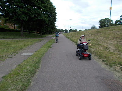
So, that's another RideLondon Freecycle done and as usual, there was a cracking turnout. I'm going to keep it short this week and let the photos do the talking, but first, a few thoughts.

Perhaps it's because I'm getting more attuned to non-standard and adapted cycles because of some research I have been undertaking recently, but I am convinced there were more out for the event this year than ever before. Of course, there's always some crazy cycles, but there were cargobikes, adapted cycles, recumbents - well, you'll see more in a minute.

I say it ever year, but if you give people proper protection from motor traffic, then they will be out in their droves. Where people feel really safe, you'll see all manner of machines being ridden by all manner of people. So, I give you the Beyond The Bicycle Edition of the Freecycle.


Sunday, 23 July 2017

Zone Control

I wrote a blog post on traffic orders quite a while back, but I though it worth returning to the subject to talk about the use of pedestrian and cycle zones which are normally a town centre thing, but it needn't be so.

I'm no fan of the Organised Taxi Lobby™, but some people rely on them and even I must accept that lorries are going to be with us for a while yet, so I though it worth showing how we can use the tools we already have to enable selected access to specific areas;

Actually, I think most of you will have seen some of this in action in pedestrian zones which (at their purest) allow walking and cycling at all times with time-based access for deliveries;


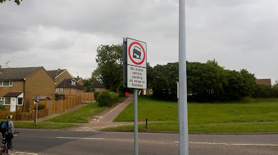
The sign above means that the area beyond is a pedestrian zone which operates all of the time into which no motor vehicles (the circular sign) are permitted unless they are loading between 5am to 10am, Sunday to Friday and 5am to 9am on Sunday. The yellow "at any time" means there is no waiting - in other words, if you're in there, it's just for loading; the sign replaces double yellow lines (with repeaters in the zone). The road is also one-way for motor traffic and two-way for cycling (the separate blue sign at the top).

The circular sign in left blank (i.e. no picture of the car and motorcycle) then it would mean "no vehicles", including cycles. It's daft, but sadly prevalent in the UK where deliveries are allowed (at certain times), but cycling is banned.

The properly up to date sign is a "pedestrian and cycle zone";


There is lots of flexibility with this sign. If the time period in the top panel is omitted (like in the photo above) then the zone operates at all times (we can select the times it operates too. The middle panel provides various exceptions which can be in any combination;

  • the legend “buses” or “local buses”
  • the legend “taxis”
  • the legend “for access”, “for loading”, or “for loading by” and the goods vehicle symbol
  • the legend “permit holders”, “permit holder”, and, if appropriate, a permit identifier or identifiers
  • the disabled badge holder symbol
The middle panel can include a time period (as with the photo above) and the time period in the lower panel can also be varied (more like a single yellow line). The lower panel can also be omitted, plus the middle panel can be omitted when the lower panel is omitted. Let's look at some examples;


The sign above tells us that the pedestrian and cycle zone operates all the time, but anyone can load (not just lorries in this case) and taxis can be driven through. Let's have another;


In this case, the pedestrian and cycle zone operates 7-days a week, but between 8am and 6pm. Outside of these hours, anyone can drive through. The only people allowed to enter the zone during the hours of operation are those with the correct permit. OK, one more;


This would be a part time pedestrian and cycle zone which operates on weekdays for an hour in the morning and afternoon. Blue badge holders and permit holders are excepted. This could very easily be a scheme around a school, although because the times will always be the same, there will be a theoretic disadvantage to those wishing to bring a vehicle into the area during holidays - they couldn't (we can't use "term time" on a traffic sign because dates always change).

Having stated this, Edinburgh have manged to get round the term time issue by have the zone operational when lights flash;


This will have "non prescribed traffic signs" approval (under Scottish rules) and forms part of a bigger scheme of "school streets" in the city which seeks to prevent parents driving their children to the school gate.

Zones should also have an end (so people know they have left);


I think this is a great tool and more should be made of it our of town centres as Edinburgh has done. It's not going to work everywhere and it needs enforcement to be effective (although we can use cameras), but in the quest for lower levels of traffic in those places where people live, work and play, we really could push out those who we don't want to drive through an area without to badly affecting those who might need to get in.

Sunday, 16 July 2017

On Your Bike!

This is straight from the Ministry of Stating The Bleedin' Obvious, but I wonder how many people involved in the design, construction and management of walking and cycling infrastructure actually go out and experience what they build on foot or bike?

I've had the opposite thrown at me where it is suggested that younger engineers who don't drive shouldn't be designing "motoring" infrastructure. The argument might have a sliver of point, but the UK design approach rooted so deeply in motor traffic use that much of the references one can use are concerned with accommodating motor traffic. This certainly applies to standards such as the Design Manual for Roads and Bridges as well as more rounded advice such as the now decade old Manual for Streets. It is therefore not especially difficult to design a road layout (in theory), even if one is not a driver because the geometry in which motor vehicles operate is very well defined in guidance. Of course, engineers are trained and they do gain experience so it's not if we are dropping people in at the deep end.

In contrast, there is little modern "official" UK-wide design guidance for active travel and so local and regional publications have appeared to fill the vacuum as well as guidance coming from the industry. As good as some of this stuff is, it never quite has the gravitas of national standards. Sadly, the government appears to have little interest in active travel and its design and delivery is passed off as a matter for local highway authorities. Engineers like to be able to thumb through design guidance and there are many influenced by what they read. Documents such as "Cycle Infrastructure Design" (9 years old) are out of date and don't really grasp what is required, but designs based on it keep popping up. Walking fares even more poorly - perhaps because it is assumed that everyone does it!

Anyway. My point was about people involved in the design, construction and management of walking and cycling infrastructure experiencing what they build (and I'll extend that to decision-makers and the police). Social media is awash with "crap cycle lanes" and staggered pedestrian crossings so it is easy to get drawn into a fug about how this is all delivered, although I do find the Cycling Embassy of Great Britain's "Insert Loved One Here" campaign to be a powerful way of highlighting the inadequacies of cycling infrastructure.

It's important to point out poor layouts, but in many ways I think it is more important to showcase what is good. It is even better to get out and experience it; actually it's vital to get out there and experience it with a technical eye. If people designing a narrow staggered crossing had to go and experience it from a mobility scooter or cycle along a bus lane with buses then we might see a change in approach. 

Saturday, 8 July 2017

Traffic Signal Pie: Staggering!

The endearing design culture of the UK places motor traffic capacity at the top of the list and nothing highlights this more than staggered pedestrian crossings.

It's a sweeping statement and one must beware of such generalisation because it doesn't apply to every situation. However, in many places in the UK, it is the de facto approach and while we continue with it, we are not going to provide a decent level of service to those moving under their own power.

It is often argued that providing staggered crossings enables crossing opportunities to be provided where there ordinarily wouldn't, but this is because of motor traffic capacity. Let's look at an example;


The diagram above shows a simple, signal controlled crossroads. The "method of control" is very simple and involves just two stages; north-south traffic and then east-west traffic. Those turning right are expected to find a gap in which to turn right.

From a pedestrian point of view, there are no green men and it's a case of trying to find a gap within which to cross, which is easier said than done. The crossing opportunity will be in any breaks in traffic flow or between the stages (called the "intergreen", where all traffic is held on a red signal between opposing stages). In this situation, the intergreen is sometimes made longer than is required for traffic to clear the junction in order to give pedestrians a chance to cross the road (although in some cases, drivers are savvy to this and see it as a chance to treat the amber signal flexibly).

The simplest way to introduce green men at this type of junction would be to add a third, "all round" pedestrian stage - all traffic is held and all pedestrian crossings run together. However, given that junctions are set up for an optimum cycle time (the time for everyone to get a green), the time from the green pedestrian stage would come from the two traffic stages in the case of a retrofit, thus reducing traffic capacity. If the junction is stuffed now, it will only get worse for motor traffic congestion!


The problem with an all round pedestrian stage is that in terms of moving people through the junction, one person crossing on one arm will hold up everyone else passing through. The flipside is that if the junction has light pedestrian flows, then for most of the time, the junction will operate on two-stages because the pedestrian stage will depend on demand (i.e. people pushing the button).

The disadvantage to people on foot here that if they wish to cross a diagonally opposite, then they have to cross two crossings and this means a longer time to cross. We can provide an "X-crossing" which permits the diagonal movement in the same time;


In traffic capacity terms, the X-crossing is going to have limits. Pedestrian crossing time is governed by walk distance and very large junctions will mean long crossing times and less for other movements given we are aiming for an optimum cycle time.

Many city-centre crossroads are space-constrained and in my view, the 3-stage arrangement with X-crossings should perhaps be the norm (notwithstanding the motor traffic-reduction debate). If you watch at a relatively compact junction like this, you'll often see people crossing diagonally. In London, we have made extensive use of pedestrian countdown and I think this has helped many judge the time to make a diagonal crossing. (Photo below, X-crossing outside Hatfield Station).


Where we have larger junctions or we are designing to maximise motor traffic through-put, the solution has often been to add staggered pedestrian crossings. Rather than being able to cross the arms of the junction in one go, pedestrians have to cross in two (or often more) parts which is often called "walk with traffic";


There are a variety of layouts with staggered crossings, but the one above is relatively (!) simple and assumes each arm carries roughly the same amount of traffic (which is a criteria for how a stagger would be designed). It has more stages than my early examples, but we might have heavier right turn movements which means we need to split opposing arms, otherwise right turners are going to lock the junction up (and this is all theoretical for the purposes of trying to explain it!)

A crude all-round pedestrian stage arrangement based on an 88 second cycle (for ease of maths) could be as follows (note that this is stage time, not green time);
  • 33 seconds north-south
  • 33 seconds east-west
  • 22 seconds pedestrians
Whereas the staggered arrangement could simply be 22 seconds per arm as there isn't specific time given to pedestrians. 

If one was walking on my staggered example and wanted to cross the northern arm from west to east, then Stage 3 and Stage 4 would enable that movement. Crossing from east to west, one could cross the first half under Stages 1, 2 and 4 and then complete when Stage 3 came in. If one wanted to cross northeast to southwest, then it could be done as follows;
  • Stage 1 - walk south over first half of western arm,
  • Stage 2 - walk south over second half of western arm,
  • Stage 3&4 - walk east over first half of southern arm,
  • Stage 1 - walk east over second half of southern arm.
The photo below is a staggered crossing at the junction of Seagull Lane and Western Gateway, London Docklands.


In design terms, we often end up looking at individual junctions (or groups over a network) in order to maximise their capacity for motor traffic, rarely stopping to think what the streets under this control are or for who they should be. This week, I found that the London Assembly Transport Committee is undertaking an investigation into walking and cycling at Outer London junctions.

Led by Caroline Russell AM, we are rather tellingly informed that;

"Small pockets of improvement don’t change the fact that most London streets are dominated by traffic and noise. They are hostile places even to step out into for a pint of milk."

This could apply to anywhere in the country. On trunk road-style urban roads, then motor traffic capacity is going to feature heavily, although in those cases, pedestrian (and cycle crossings) are often only provided across the main road as staggered arrangements, because adding green men at side roads creates traffic capacity issues (unless the junction is vast and has stacking space on the side roads). As we move to town centres, we still see staggered crossings in what are meant to be places where people wish to shop - indeed they are very hostile places.

I would suggest that if we take a step (!) away from thoughts of making streets work better for people walking, then staggered crossings can be a way to provide for traffic flow and safer crossing opportunities. This is sometimes the position taken by traffic signal engineers who often come at this from the numerical purity of a mathematical problem to be solved, and of course, those who call the shots are often interested in traffic capacity.

We should remember that traffic signals are there to manage conflict. Either vehicle to vehicle (including cycles) or vehicle to pedestrian. If we took the motor vehicles out, we'd not need signals because cycle to pedestrian conflict is easier to manage. When signals are removed without significant vehicle reduction, then we get conflict as can be observed in some street regeneration schemes which fail to address the key question on what or who the street is for.

There is a campaign running from British Cycling at the moment called "Turning The Corner" which is pushing for a universal rule that people walking and cycling should have automatic priority where crossing side roads. Taken to it's conclusion, this could apply at signalised junctions which would simplify the stages needed and there make them more efficient for everyone and so we wouldn't need staggers - certainly common outside of the UK. This video provides a deeper explanation (although from a USA perspective).

However, this approach would need changes to UK rules and at the moment, there seems little interest from the Government. Additionally, some people are worried that expecting turning drivers to give priority to people crossing side roads is fraught with risk and lessens the protection (perhaps perceived) of the green man - some of this risk would be mitigated with appropriate junction layouts and zebra crossings to reinforce priority, but I can understand the concern given how long we have had our layouts.

My own view is that challenging how we do things is absolutely right, but that we shouldn't be waiting for these challenges to make it into legislation. We need to keep pushing to rebalance our streets away from motor traffic, but also accepting we are going to have cars with us for some time. If we shift the balance then my all-round pedestrian stage example could mean that we give the pedestrian crossing stage every other stage, rather than every third stage.

What was gratifying to see this week was a proposal from Waltham Forest council who are clearly not waiting for legislation to change and are just getting on with modernising their road network as part of the Mini-Holland programme. The council is currently consulting on changes at the junction of Forest Road and Blackhorse Road which is a signalised crossroads featuring a staggered pedestrian crossing on each arm. The council is proposing to ditch it in order to provide straight through crossings which will operate on an all-round basis for people walking and cycling;


As usual, our designers can show a different way forward. It's the political job to make this change happen. What's gratifying for me is that after blogging about this kind of layout three years ago, we are getting some real life UK examples to see. I cannot claim credit, but I'll claim that I was right!


Saturday, 1 July 2017

#HertsRun Part 2: Stevenage - Unfinished Business

In my last post, I recounted a recent cycling safari which started in Hatfield and I left you with as close to a cliffhanger as I can get with kerbs at the edge of Welwyn Garden City. This post completes the journey which ended up in the New Town of Stevenage.

To recap, then. The cliffhanger was the entrance to an underpass;


To be precise, this is the junction of the A1000 Chequers/ Howlands/ Chequersfield which to those driving is nothing particularly exciting. For those walking and cycling, it's something a little unusual. The roads approaching the roundabout ramp up which means that the ramp down into the underpass isn't as steep as it might otherwise be and so keeps everything compact (relatively speaking);


The centre of the roundabout is open to the sky and the visibility through the tunnels is good (no 90° turns at a subway wall here). What is noticeable is the age of the infrastructure. This has been around a long time with the faded red cycle tracks, small clumps of weeds at the edge of the paving and not quite 100% perfect accessibility for pedestrians. However, what this also says is the original design and construction was pretty much bullet-proof. Let's take a quick ride through;


We carried on our journey along the shared-use cycle track next to the A1000 and skirting the centre of Welwyn Garden City. The provision was back to the usual UK sharing with toucan crossings and giving way at side roads and it was clear that the highway network was there for mass driving, not active travel. The underpass seemed to be very incongruous compared with everything else.

We eventually headed through a residential area where NCN12 was signed and on into Sherradspark Wood where we ended up on an unsurfaced track. It was pleasant enough, but a leisure route rather than useful for daily transport. We crossed the A1(M) on a bridge into Ayot Green which was marked as a "Quiet Lane".


It was actually very quiet for a while as we passed through the countryside skirting Codicote and on towards Old Knebworth (still following NCN12). This was pure leisure cycling and great fun it was too.


We managed to take in some serious hills (compared to what we were usually used to) which was interesting given the type of bikes we had (2 folders and a 3 gear upright). Eventually, we reached the edge of Stevenage and after dicing with maniac drivers on Old Knebworth Lane we were directed onto a truly terrible traffic-free link which you can see at the end of this video;


So we had arrived in Stevenage. I am not even going to try and explain how the town was designed and laid out and there's no need as others have written about it such as Carlton Reid in this in-depth article. The short version is that my new local engineering hero, Eric Claxton, was the chief engineer of the multi-disciplinary team who designed and built the New Town.

What we have in Stevenage is a network of "cycleways" (Claxton's name for them) which are completely separate from the main road network. Alex, Hester and I rode around these cycleways for a couple of hours with barely an interaction with motor traffic. Like the Welwyn Garden City underpass above, Claxton's network is jaded, but long lived and certainly, maintenance and upgrade works take place;


To cycle round in comfort and safety was wonderful, but there was something not quite right. We had lunch in the town centre and like Hatfield, cycling is banned (although this was sensibly being ignored);


The town centre is very smart given its age and it functions well as a pedestrian precinct. From a cycling point of view, none of the cycleway network actually takes you into the town centre and so you are back mixing with motor traffic. We also got off the main cycleways and ventured into an industrial area and into some of the residential areas;


The older parts of the town had spurs from the cycleways, but the newer areas didn't and within a few metres we could have been anywhere in the UK, although there was some attempt to keep the cars off the footways;


The trouble with Stevenage is that in terms of active travel, it is unfinished. The cycleways are the same as when they were built with little evidence of expansion into the residential and commercial/ industrial areas. The protection quickly fizzles out in many residential areas and the town centre is actively hostile to cycling. The town is also sprawling and in many respects it still takes quite a long time to get around by bike (you wouldn't bother on foot for most of it).

There is also a highly developed and accessible motoring network which means that it is easy to get around by car. Many parts of the cycling network felt like a long slog to use between any place of interest.


There is some interesting data in the Hertfordshire County Travel Survey for Stevenage (2015);


The area has a 4% mode share for cycling to work which is just above Hertfordshire's 3% mode share (the UK average is 2%), but it also has a whopping 71% mode share for driving to work (that's driver) compared to 59% for the county. For school travel, cycling is lumped in with "other" for the town with 45% of school journeys being made by car;


This is all against a backdrop of the town having more people without access to a car than the county average.


These are just a few facts, but I think they help to show that despite the cycleway network, Stevenage is firmly a car town within which it is easy to drive.

I'll leave you with a video of some of the cycleway network as I think we can relearn a great deal of the engineering - but we also need the realise that this needs to properly connect people to their homes, jobs and town centres. We can also learn a great deal about the town planning because many mistakes were made in Stevenage.