
So, I'm back from my family holiday on the other side of the North Sea, but I did find some time to look at infrastructure (between the ice-creams and travelling).
My blog posts about the Netherlands last year were themed, but this time, I'm going to write about some of the places visited in the round. First is the island of Fanø which is just off the North Sea coast of the Danish part of Jutland. As ever, these blog posts can only ever be a snapshot of what I saw and can never replicate the experience of living with and using these layouts.
The island has three main centres - Nordby, Rindby and Sønderho - the first being the main (small) town and the others villages. They are connected by a shared-use cycle track which runs on the eastern side of the island, generally following the main north-south road on the island. There's also an east-west route connecting the central village of Rindby to Rindby Stand on the west, again running next to the main road (below).

This shared-use cycle track next to a main road layout is very common on the European mainland and certainly we saw a similar approach along the German North Sea coast, across Denmark and in southern Sweden. The difference in Denmark was that a centre line is marked. In common with other countries, these rural cycle tracks are provided on one side of the road.


As you can see above, the cycle track is simply signed and this is consistent applied across the Danish network. Of note, being a shared path, pedestrians are denoted at the top of the sign in contrast to the UK approach of having them at the bottom. You will also note the use of little give way triangles where one track meets another. In my view, the signs are much larger than needed and I prefer them lower to be on a human scale; but they are all totally consistent.


Fanø has quite an extensive road network for such a small place, but other than the town and village centres, the roads are little more than unsurfaced tracks in places. However, whenever they meet a cycle track, drivers are expected to give way and cycle priority is reinforced with logos. In practice, I found drivers gave way to people walking too (which seems to be well observed in Denmark).

This priority extends to larger junctions. The above photo is the junction of two of the main roads on the island and you can just make out drivers giving way to a woman cycling through. Below, we have a closer view. The cycle track carries through the junction - reinforced by the cycle logos. The cobbles either side form a very slight ramp.

The cycle track is bent in from the minor road which means that drivers turning off the main road have space to stop to allow people to cross. My exploration of this part of the island was on foot and drivers equally gave way to me. This type of layout is possible in the UK (it has been for decades). Of course, this layout will not be appropriate everywhere - if motor traffic flows are high, the chances are that the junction would need to be signalised or a roundabout provided such as the Dutch use in rural places.

As you can see above, this simple, but very useable network is suitable for kids to use on their own!

The cycle tracks are machine-laid with asphalt concrete (DBM in old money) and there are no kerbs (other than when the cycle track is next to the road) - the sub base is wider than the track and the surfacing layers stepped in.

In terms of width, there are some variations, but they are around 3.5m in width (sometimes a touch wider, sometimes narrower), but generally suitable for side by side (social) cycling with overtaking in the other lane.

The island has its own bus service which has some stops being just flags at the side of the road and some in laybys (above). The cycle track passes behind the laybys with an area of hard standing providing separate boarding space.

Much of the main cycle track network has decent separation from traffic with a verge and as can be seen above, it often contains a drainage ditch. This is a very simple layout and should be the UK standard - where we have a road with hedges on either side, the very clear answer is acquire land on the other side of one of the hedges - we are happy to spend millions on land acquisition for UK road schemes in the countryside.

I walked between Rindby Strand (above) and Nordby which is about 30 minutes (no more than 10 minutes by bike). In both directions, I was the only person walking until I hit each settlement and so mixing walking and cycling wasn't a problem. The marked centre line was useful for ensuring I stuck to one side or the other as not to get in the way of people cycling - I found walking towards cycle traffic to be the most sensible as I wasn't surprised!

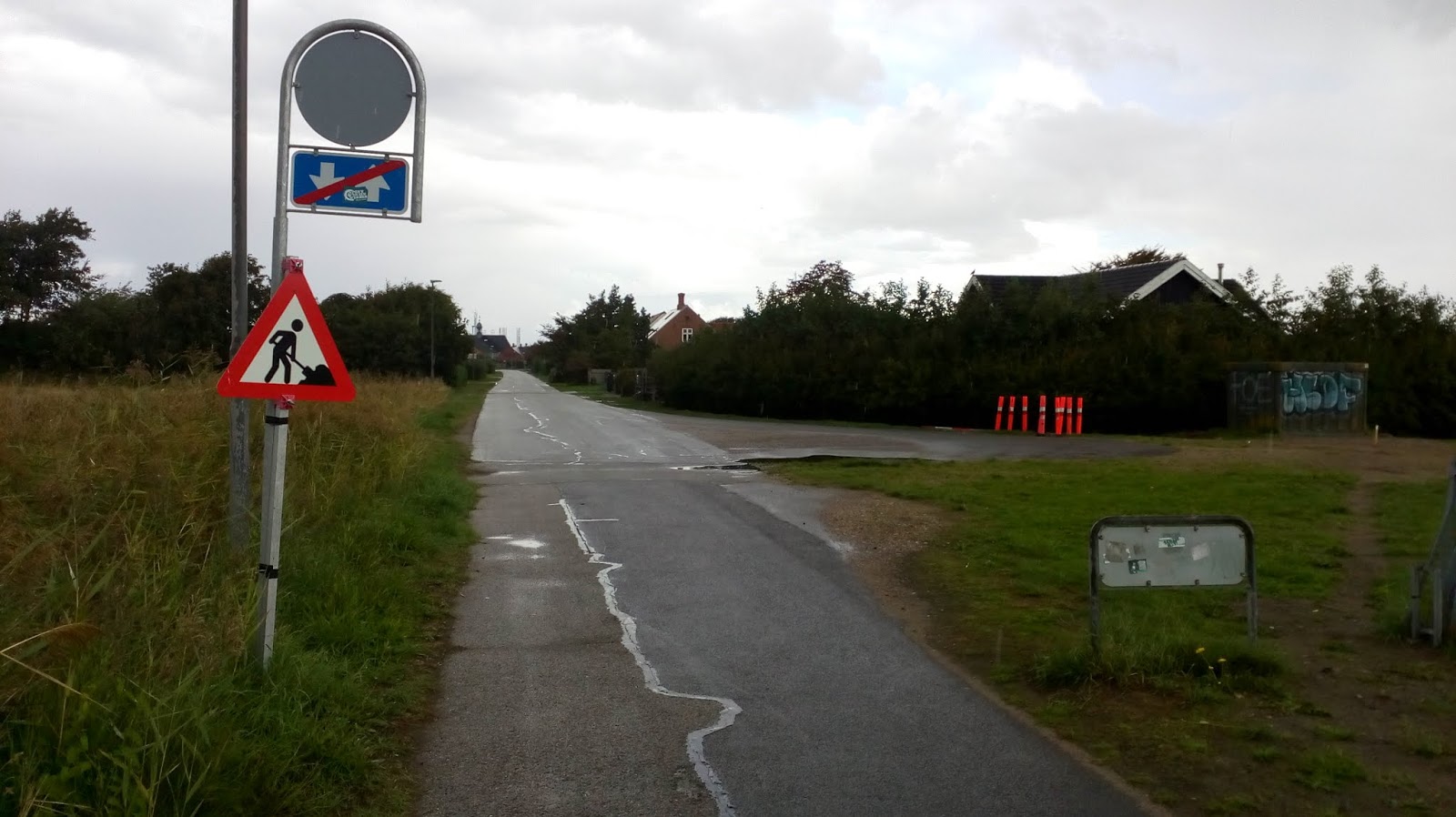
Approaching the edge of Nordby, the cycle track ended with a very simple sign (above) and I was deposited at one end of a short cul-de-sac. There was no footway, but also there was no traffic, so it was fine.

Above is the view in the other direction as the cycle track starts - no staggered barriers or bollards used here. The sign on the left says "path to Rindby and Sonderhø".

As an aside, there was another sign a little further along referring to the "Panoramarute", a 26km circular tour of the island.

There is an anomaly to the shared-use cycle track on one of the other main roads on the island (above) where separated footways and one-way cycle tracks are provided. The distinction between the two is subtle in terms of a different paving rather than anything else in terms of tactile demarcation or tracks being stepped. Apart from a couple of locations on the main north-south road, one can cycle on the roads of Fanø, but most stick to the cycle tracks.
Approaching Nordby, there was no cycling infrastructure, but people clearly felt safe because of low driver speeds and low motor traffic volumes. Even on a wet day, there were still plenty of people out on their cycles, including a couple of cargocycles and trailer users (below).

Those familiar with Copenhagen will be aware of the "Danish-fillet" (I'm not sure if there is a local name). That is, a line of tarmac dobbed into the edge of the carriageway to provide a ramp over a kerb. The photo below shows that this practice has made it right over to the west of the country (in fact, I saw it everywhere).

From a walking along the footway point of view, this is excellent because the footway width is maximised and there's no dropped kerb to interfere with the crossfall. However, it's not a tidy look, creates a trip risk for those crossing the road and if one were cycling up it to get to their home, then it's really steep. More about this in a later post.
The roads around the centre of Rindby are filtered and the core is pedestrianised with people cycling permitted. This means that drivers have to go the long way round rather than nipping through the historic town core.

The photo above shows an entry point into a Gågade or "pedestrian street". The sub plate (see below) explains that driving is allowed between 6pm and 11am - there are residents and business inside the core who might need to get vehicles in/ out.

The other thing to note about the core of Rindby in traffic management terms is the use of "no motor vehicles" signs at key points (below) which essentially create the condition where drivers go one-way and people cycling can travel both ways. This in turn means that the clutter of one-way signs and contraflow cycling is eliminated.

A driver could go in both directions beyond the sign, so the key is placing the restrictions in such a way as there is no advantage driving into the town unless you need to be there - i.e. any through traffic must stick to main roads.

Away from the traffic management, there is a subtle detail provided in the centre of Rindby which is full of bumpy stone setts (above and below) - an asphalt edge to the carriageway as been provided to cycle on. The setts help act as a traffic calming device and of course the asphalt is nice and smooth.

Away from the town centre, a cycle track runs along the main road which passes Rindby (below). Both the main road and it's cycle track means that through traffic of both wheeled kinds is routed away from the town centre. This is important because the town centre is pedestrian-oriented and through-cycle-traffic would create conflict. This is something that the UK cannot grasp and yet a tiny town on a tiny island in Denmark has managed it.

This particular cycled track leads to the island's ferry terminal which supports to the Fanø to Esbjerg Ferry, which is an important lifeline (below). There is an interesting arrangement where the island's ambulance service works with the ferry company to ensure people needing urgent medical help can be evacuated to Esbjerg, even overnight when the ferry doesn't operate. The ferry is also important for commuters (to and from the island) and secondary school children (as their school is on the mainland).

In the same way as a railway station might integrate with cycling, so does the ferry terminal. A huge cycle park is provided (for a little island) right next to the terminal (below) and is closer than the car park!

Integration is completed by it being possible to cycling on and off the ferry;

Once off the ferry, you immediately join the cycle track for your onward journey;

Fanø is a lovely place to visit and I wish I had been able to grab a bike and have a longer bit of exploring. However, it shows an easily scalable system of rural cycling provision which would work in the UK. I'll leave you this week with a nicer way to end a cycle track than a cyclists dismount sign and the big skies of the North Sea.


This priority extends to larger junctions. The above photo is the junction of two of the main roads on the island and you can just make out drivers giving way to a woman cycling through. Below, we have a closer view. The cycle track carries through the junction - reinforced by the cycle logos. The cobbles either side form a very slight ramp.

The cycle track is bent in from the minor road which means that drivers turning off the main road have space to stop to allow people to cross. My exploration of this part of the island was on foot and drivers equally gave way to me. This type of layout is possible in the UK (it has been for decades). Of course, this layout will not be appropriate everywhere - if motor traffic flows are high, the chances are that the junction would need to be signalised or a roundabout provided such as the Dutch use in rural places.

As you can see above, this simple, but very useable network is suitable for kids to use on their own!

The cycle tracks are machine-laid with asphalt concrete (DBM in old money) and there are no kerbs (other than when the cycle track is next to the road) - the sub base is wider than the track and the surfacing layers stepped in.

In terms of width, there are some variations, but they are around 3.5m in width (sometimes a touch wider, sometimes narrower), but generally suitable for side by side (social) cycling with overtaking in the other lane.

The island has its own bus service which has some stops being just flags at the side of the road and some in laybys (above). The cycle track passes behind the laybys with an area of hard standing providing separate boarding space.

Much of the main cycle track network has decent separation from traffic with a verge and as can be seen above, it often contains a drainage ditch. This is a very simple layout and should be the UK standard - where we have a road with hedges on either side, the very clear answer is acquire land on the other side of one of the hedges - we are happy to spend millions on land acquisition for UK road schemes in the countryside.

I walked between Rindby Strand (above) and Nordby which is about 30 minutes (no more than 10 minutes by bike). In both directions, I was the only person walking until I hit each settlement and so mixing walking and cycling wasn't a problem. The marked centre line was useful for ensuring I stuck to one side or the other as not to get in the way of people cycling - I found walking towards cycle traffic to be the most sensible as I wasn't surprised!
Approaching the edge of Nordby, the cycle track ended with a very simple sign (above) and I was deposited at one end of a short cul-de-sac. There was no footway, but also there was no traffic, so it was fine.

Above is the view in the other direction as the cycle track starts - no staggered barriers or bollards used here. The sign on the left says "path to Rindby and Sonderhø".

As an aside, there was another sign a little further along referring to the "Panoramarute", a 26km circular tour of the island.

There is an anomaly to the shared-use cycle track on one of the other main roads on the island (above) where separated footways and one-way cycle tracks are provided. The distinction between the two is subtle in terms of a different paving rather than anything else in terms of tactile demarcation or tracks being stepped. Apart from a couple of locations on the main north-south road, one can cycle on the roads of Fanø, but most stick to the cycle tracks.
Approaching Nordby, there was no cycling infrastructure, but people clearly felt safe because of low driver speeds and low motor traffic volumes. Even on a wet day, there were still plenty of people out on their cycles, including a couple of cargocycles and trailer users (below).

Those familiar with Copenhagen will be aware of the "Danish-fillet" (I'm not sure if there is a local name). That is, a line of tarmac dobbed into the edge of the carriageway to provide a ramp over a kerb. The photo below shows that this practice has made it right over to the west of the country (in fact, I saw it everywhere).

From a walking along the footway point of view, this is excellent because the footway width is maximised and there's no dropped kerb to interfere with the crossfall. However, it's not a tidy look, creates a trip risk for those crossing the road and if one were cycling up it to get to their home, then it's really steep. More about this in a later post.
The roads around the centre of Rindby are filtered and the core is pedestrianised with people cycling permitted. This means that drivers have to go the long way round rather than nipping through the historic town core.

The photo above shows an entry point into a Gågade or "pedestrian street". The sub plate (see below) explains that driving is allowed between 6pm and 11am - there are residents and business inside the core who might need to get vehicles in/ out.

The other thing to note about the core of Rindby in traffic management terms is the use of "no motor vehicles" signs at key points (below) which essentially create the condition where drivers go one-way and people cycling can travel both ways. This in turn means that the clutter of one-way signs and contraflow cycling is eliminated.

A driver could go in both directions beyond the sign, so the key is placing the restrictions in such a way as there is no advantage driving into the town unless you need to be there - i.e. any through traffic must stick to main roads.

Away from the traffic management, there is a subtle detail provided in the centre of Rindby which is full of bumpy stone setts (above and below) - an asphalt edge to the carriageway as been provided to cycle on. The setts help act as a traffic calming device and of course the asphalt is nice and smooth.

Away from the town centre, a cycle track runs along the main road which passes Rindby (below). Both the main road and it's cycle track means that through traffic of both wheeled kinds is routed away from the town centre. This is important because the town centre is pedestrian-oriented and through-cycle-traffic would create conflict. This is something that the UK cannot grasp and yet a tiny town on a tiny island in Denmark has managed it.

This particular cycled track leads to the island's ferry terminal which supports to the Fanø to Esbjerg Ferry, which is an important lifeline (below). There is an interesting arrangement where the island's ambulance service works with the ferry company to ensure people needing urgent medical help can be evacuated to Esbjerg, even overnight when the ferry doesn't operate. The ferry is also important for commuters (to and from the island) and secondary school children (as their school is on the mainland).

In the same way as a railway station might integrate with cycling, so does the ferry terminal. A huge cycle park is provided (for a little island) right next to the terminal (below) and is closer than the car park!

Integration is completed by it being possible to cycling on and off the ferry;

Once off the ferry, you immediately join the cycle track for your onward journey;

Fanø is a lovely place to visit and I wish I had been able to grab a bike and have a longer bit of exploring. However, it shows an easily scalable system of rural cycling provision which would work in the UK. I'll leave you this week with a nicer way to end a cycle track than a cyclists dismount sign and the big skies of the North Sea.


Sorry to be a bit cynical but if they did the cobbles for the motorists and smooth for the cycle route in the UK you'd get a lot of drivers with a wheel on the cycle track. I have seen too many occasions one half on the pavement to avoid all wheels going over a speed bump.
ReplyDeleteThank you, this was a nice read.
ReplyDeleteI have always appreciated the reduction in signing and lining clutter in the Nordic countries compared to UK & IRL, where we like to be road 'tattooists'.
Do you know if the traffic management of Nordby is typical of a Danish town or is this a special case due to it being a tourist spot? I agree when you say it is something that the UK just cannot seem to grasp. In Ireland we get objectors worried about 'loss of footfall' if we attempt to remove the traffic jams from the high streets.