Sunday, 30 May 2021

What Is A Dutch Style Roundabout?

Look, I don't want to be that guy, but when I see a UK cycling scheme trumpeting a "Dutch-style" roundabout, it's going to get my attention and I'm going to give it a closer look.

North Tyneside Council is currently consulting on a raft of cycling schemes which are being delivered over the next couple of years using funding from the UK Government's Active Travel Fund (ATF) and the Transforming Cities Fund (TCF). The former is essentially part of the response to Covid where 2020/21's fund was more about pop-up and interim active travel works with 2021/22 being about making things permanent or extending them. The latter closed to applications in 2018 and is about investing in public and sustainable transport in city regions. Both funds are for England only.

The principal problems with the funding are that they are part of the long stop-start tradition with bidding that has made delivering cycling (and walking) infrastructure difficult to plan for. Inevitably, local authorities don;t have certainly in building their own capacity and so lots of projects are delivered using consultants' help (and there I declare a general interest), rather than being able to deliver the core themselves.

I thought it important to set some context here because the fact is that North Tyneside is actually trying to create a better cycling network which is head and shoulders above many English authorities. The council says that it has £1.6m ATF funding and £7m TCF funding, although the ATF money is time-limited to March 2022 (another Government-imposed deadline). Have a look at the plans yourselves and I would encourage locals to respond. For this post, I am going to concentrate on the aspect that caught my eye.

The roundabout in question is on the A191 Rake Lane and forms a junction with Billy Mill Lane and Brookland Terrace (In the consultation it is called the Rake Lane Roundabout). The A191 and Billy Mill Lane are large single carriageways with little frontage development (there are parallel streets operating like service roads). This roundabout is part way along wider plans for the A191 corridor between the New York Road roundabout in the west and the Preston Road North roundabout to the east. 

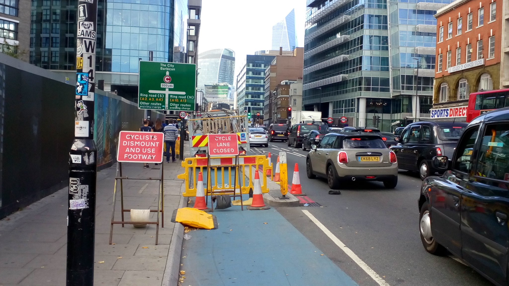
The general treatment for the A191 is to reduce the speed limit to 40mph west of the Rake Lane Roundabout (New York Way) and then provide cycle lanes on the carriageway with wand or orca protection. To the east of the roundabout the speed limit is already 30mph, but the same lanes with wands/ orcas are proposed (there is already an eastbound advisory cycle lane). The cycle lanes pass in front of bus stops and there are also long gaps in the protection at junctions.

There are also parallel zebra crossings proposed (generally where refuges are removed) and a couple provide access to the North Tyneside General Hospital which is a good place to serve. Unfortunately, the westbound cycle lane gives up at the hospital entrance (below).


From the plans at least, the cycle lanes appear to be advisory which is immediately an issue because drivers are allowed in them from time to time - this is in direct conflict with putting in the light protection. These should be mandatory lanes. But it's academic because the A191 looks pretty much terrifying for most people and I really can't see how paint and a few wands or orcas will make people fee safe. This is especially true of New York Way which will have a 40mph speed limit (below).


New York Way is about 10m (maybe a touch narrower). If the minimum cycle lane width of 2m is provided (6.4.2 in LTN1/20), that leaves traffic lanes of 3m which are not appropriate on a 40mph road like this. I suspect these lanes will be 1.5m which will feel very exposed. The road also has little frontage access and so I wonder who will be using it, especially as the light protection ends at the west end.


Figure 4.1 from LTN1/20 (above) is useful in this context. For a 40mph limit with cycle lanes, we get a pink box which states;

"Provision suitable for few people and will exclude most potential users and/ or have safety concerns"

Light segregation gets us into the amber area which states;

"Provision not suitable for all people and will exclude some potential users and/ or have safety concerns"

For my mind, the distance between wands/ orcas on the plans isn't particularly dense and I simply cannot see how most people would be reassured. I wouldn't cycle on New York Way full stop.

For the eastern side of the corridor, we can use the same figure to look at what happens with a 30mph limit. For light segregation at all traffic flows we are into the green, but again, I would still have concerns about the level of protection provided. This is an A-road corridor with a character that is not built up and urban; it is suburban fringe and this shouts cycle tracks to me. Some sections have the service road which could be properly filtered as a kind of cycle street too.

OK, that's a fair bit to talk about before getting to the roundabout design, but the wider network context needed to be considered. The roundabout itself is is very large at around 75 metres diameter (it's a bit oval) to the carriageway edge of the circulatory area. There are two wide traffic lanes around it and each of the 4 entry roads are single carriageways which splay out to 2-lane entries. The exits are single lane, but very wide and the arrangement means that drivers are able to drive quickly into and out of the roundabout. 

The roundabout dates back from the end of the 1960's/ early 1970's. Looking at Old Maps you can see Billy Mill Lane being widened and straightened on the 1966/69 OS map and by the 1971/77 OS map, the roundabout exists. You can look around to see housing development in the general area from the early 1950s through to the 1970s - a growing suburbia with road building - it seems nothing changes.

For the cycling scheme, there are two proposals for the roundabout. I'll look at Option 2 first;


This option has mandatory cycle lanes on the two Rake Lane approaches and the Billy Mill Lane approach (which of course makes more sense that the advisory lanes on the wider plans). Brookland Terrace has advisory lanes. In all cases, the cycle lanes end at the roundabout entrances.

Each arm receives parallel zebra crossings. Brookland Terrance is single stage and the others are 2-stage given the wide islands which makes sense. The centre of the circulatory area is hatched, although the single traffic lane is still wide. The existing kerb lines appear to be retained, but the cycle lanes entering the roundabout and some other hatching means there are single traffic lane entrances and exits.

For people cycling through the junction, they can either stay on the road to mix with traffic or somehow get to the shared-use areas at the zebra crossings (I assume by a dropped kerb which is accessed sideways) and navigate via 2-way cycle tracks. Because of the shared-use areas by the crossings, there is lots of tactile paving to contend with.

2-way cycle tracks in the context of a very large roundabout actually makes some sense. For example, turning right from Billy Mill Lane means you can cycle anti-clockwise around the junction via 4 parallel crossings at a distance of about 120 metres. If you did the same in a clockwise fashion, this would be much twice the distance using 3 crossings. 

Essentially the design adds cycle tracks to the existing footways around the junction and adds parallel zebra crossings. But, it is classic dual provision for the "confident" and "cautious" cyclists when we should be designing for all (or at least 95% of people). The fact that people have to use cycle lanes (even with light protection) is probably still the reason that most people won't use the new infrastructure.

Option 1 is the headline grabbing "Dutch Style" roundabout which I'll look at in a minute, but first the arrangement;


With this option, the main cycling principle is a one-way orbital cycle track (clockwise) which is created from the outer part of the circulatory area of the roundabout, separated by "flexible surface islands" according to the plan. I don't know what this means, but I assume some sort of bolt-down product.

All of the arms have 2-stage parallel zebra crossings and single traffic lane entries and exits. This is good because people cycling (and walking) only have to deal with one traffic lane at a time and drivers don;t have to worry about what is happening on the other crossing as much as they would with a single stage crossing. This is a good design principle.

The triangular "splitter" islands for each arm have been narrrowed a little and they will extend into what was the outer part of the circulatory area to create a narrower traffic lane on the roundabout and protection for people cycling. Pushing general traffic towards the centre is better than the other design of pushing it to the outer edge simply because it tightens the turn drivers have to make, but it is still about a 70m diameter give or take which really isn't going to slow drivers that much.


Looking closer at the layout (Brookland Terrace and the eastern arm of Rake Lane in this case), we can see how new splitter islands have been added which provide buffer for cycle traffic from general traffic on the entry and exit points as well as giving decent pedestrian islands between the cycle tracks and traffic lane crossings. One point to mention here is that parallel zebra crossings should have the zebra stripes and elephant feet (for the cycle size) 400mm apart. This is a stupid rule in the Traffic Signs Regulations & General Directions 2016 which technically stops us curving the cycle part of the crossing. The zebra strips are also wrong as they need to be complete rectangular blocks, but I'll put that down to a drafting error.

The problem with this layout, however, are threefold. First, people cycling and wanting to cross the parallel zebra will need to almost look behind them (more than 90° in any case) for drivers leaving the roundabout which I have shown with green arrows (above) for cyclists and purple arrows for drivers. The crossing of traffic joining the roundabout is not a particular issue because speeds will be lower. 

Second is that drivers will be able to enter the roundabout at speed as shown by the orange arrow. If they can see a gap in traffic, this means the entry speeds are high and with the alignment the exit speeds will be high. As you can see, there is a set back of the cycle crossing from the edge of the roundabout which can fit a car, but it's not enough stopping space at any real speed and so creates shunt risk from traffic on the roundabout.

This is the nub. On the whole, Dutch roundabouts which include people walking and cycling are compact. In the CROW Design Manual for Bicycle Traffic, an urban roundabout would have a diameter of between 25 metres and 40 metres (across the circulatory area) to ensure driver speeds are kept low. With a diameter of maybe 70 metres for the "Dutch Style" roundabout, there is no way that the size is remotely Dutch and in fact, the island at 55m diameter would easily contain most of a Dutch roundabout!


The traffic entries to the roundabout should be perpendicular to the circulatory area and the cycle track should be orbital (and preferably one way) with a Dutch urban roundabout; there isn't a flaring as such, just a radius between the entry lane and circulatory area (above). This means that drivers have to actually use their steering wheels to enter and exit and cyclists cross perpendicularly reducing the need to try and look behind oneself. With the Rake Lane scheme, the cycle track is not orbital, it is more like the rural option which I'll show you in a minute.

The cycle crossing is set back 5 metres which isn't an issue on a compact roundabout as drivers are moving slowly with shunt risk reduced. The crossings are single traffic lanes at a time with a refuge between the two crossings.


The photograph above is the Frederik Hendrikbuurt Roundabout in Amsterdam. It's unusual as it has a tram line running through the centre where everyone gets held by a red traffic signal, but apart from that it operates as an urban Dutch roundabout. you can see the orbital cycle track, the set back to give drivers a stopping place (and space to enter the roundabout - things being broken down by task).


We could also look at the Dutch rural roundabout where people cycling (and walking - it would be a shared-use path) give way to traffic. In this case, there is still tight geometry for traffic, but the crossing points are set much further back to give drivers more space in which to stop if someone crossing misjudges the gap. There is the same perpendicular approach for drivers; no triangular splitter islands making it easier to enter and exit. There is less need to make the cycle track one way and in many cases, there are only cycle tracks around part of the roundabout in any case.


The cycle track is not orbital, it follows the general junction shape which means that cyclists have to slow down and then turn before crossing (above). This does lead to energy losses for the cyclist, but the geometry stops people just continuing across the road as they would do with the parallel zebras of the urban example. 


You'll also see the carriageway drain to the outside which creates an adverse camber (above) which slows drivers down along with an overrun area for large vehicles which keeps space tight for smaller vehicles avoiding the overrun. This will often be the same in urban areas, it's just easier to see in rural examples.

One piece of information I don't have is the traffic flow through the roundabout. The Dutch designs allow for up to 25,000 PCU (passenger car units) a day for single lane entry. The Dutch do use multiple lane entries, but despite there being examples which include cycling, they are much less safe and should be avoided. For UK roundabouts, the geometry which allows higher entry and exit speeds mean we can push more traffic through.

So, does it matter that this scheme is being headlined as a Dutch-style roundabout? In my view, yes. "Style" is doing some very heavy lifting. In fact the only facet of the design which is Dutch is the parallel crossings with single lane entries/ exits configuration, however, without all of the other details it can never be Dutch-style. In fact the only Dutch-style roundabout is in Cambridge which has cycle priority, but also the safety features required to be called Dutch-style.

So what would I do? Well, Given the context, I don't think I would be proposing an urban Dutch design, I would go for the rural example simply because this location is not in an urban location. Assuming I wasn't allowed to dig up the central island because of cost or the trees there, I wouldn't be calling my layout Dutch-style, but I would redesign the approaches to provide rectangular splitter islands (maybe 3 or 4 metres wide) to get the perpendicular approaches for drivers. 

The crossing points would be set back at least 10 metres from the circulatory area, but I would keep the idea of pushing traffic to the inside of the circulatory area with as narrow a traffic lanes as I could get away with, but which is still compatible with HGVs. I think I would also make the cycle track 2-way because with traffic priority, it would be much safer than a 2-way track and zebra. Having it 2-way also helps is provide a 2-way cycle track on New York Way, rather than the scary lightly protected lanes.

Above is a quick sketch to the same scale to show what I mean. To the east is New York Way where I've provided a 3.5m shared-use path with a 2 metre buffer from traffic. The crossing point is set 12 metres from the edge of the circulatory area and traffic is pushed to the inside. you'll note the perpendicular approach which helps slows driver speed into and out of the roundabout. There are lots of options for the other arms. If walking and cycling numbers are expected to reach any significant numbers, then we can provide separate space, but the 2-way nature of the layout allows people to choose the quickest option for them.

My sketch is not "Dutch-style", but it does follow sustainable safety principles where we control traffic speeds and where we don't expect people to cross more than one traffic lane at a time. I think the layout better fits the local road hierarchy and while I understand the desire to provide walking and cycling priority, I am not convinced it is the safest option in the local circumstances.

Saturday, 22 May 2021

The Five Principles

Earlier this week I gave a talk to Cyclox about what I thought made good cycle routes. The talk covered the five principles for cycling infrastructure with a round up on Low Traffic Neighbourhoods.

Now, I have covered LTNs many times in this blog and so this week I thought it might be interesting to talk about the five principles. I am a fan of the details, but a little step back to look at principles is always a good idea as it helps us understand how things fit together. This post is essentially the long-hand version of the slides I used in my talk which you can watch here.

The five principles crop up in all sorts of UK cycling planning and design policy and guidance - even in the most dire of the genre! It is no surprise that they pop up in the new English design guidance, LTN1/20 Cycle Infrastructure Design, and they are covered in some detail in Chapter 4. It's also worth stating that in fact they equally apply to planning and designing for walking. The reason for this is that these principles major on the human experience of self-propelled travel.


I was probably vaguely aware of them in recent years, but it wasn't until I got myself of a copy of the Dutch "Design Manual for Bicycle Traffic" (often called the CROW manual - above) that I really started to understand how this all fits together. It also pushed me to imagine network level design being as important (possibly more important) than route design. In other words, a problem issue on a cycle route may be more easily addressed by looking at what is happening at the network level - something I talked about in by post about Lea Bridge Road in Waltham Forest where separate walking, motoring and cycling networks have been considered (below), it's just that they are on the same route for Lea Bridge Road itself.


The five principles are as follows;
  • Coherence (Dutch use Cohesion)
  • Directness
  • Safety
  • Comfort
  • Attractiveness
The CROW manual states;

In general it holds that if the minimum level cannot (or can no longer) be met for one (or more) of the five main requirements, then the infrastructure will need to be modified.

This is where we discuss what a compromise might look like, but first, we need to have a look at the five principles. The CROW Manual uses them first to define what a main cycling network should be (maybe over a 300m - 500m grid in urban areas), but as we will see, they can apply at both the macro and micro level.

LTN1/20 reminds us that accessibility should also flow through the five principles. Whilst that is absolutely true and a good thing to point out, accessibility should be implicit and integral to planning and design.

Coherence - the cycling infrastructure forms a coherent whole and links all origins and destinations.
People travel because they have certain needs to satisfy. It's obvious when you think about it, but so much cycling provision in the UK has been developed in such a way as to tuck cycling out of the way as a problem to be managed, rather than a mode to be embraced.

People need to get to work, go shopping, drop the kids off at school (or get to school themselves), get to a GP appointment or provide care assistance to others. They also want to travel for leisure or entertainment or maybe they just want to get out in the fresh air. Those reasons for travelling therefore make it an absolute requirement to be able to get from home to all of these destinations, or to link trips together. This means that we are going to have to make many roads and streets useful for cycling.


However, the cycling network is going to be different to the motoring network and the class of road or street shouldn't really matter, we need to be providing a seamless experience. 

Grove Road in Stratford (above) takes cycle traffic from the side road onto a main road. The side road has people cycling on the carriageway and the main road has a cycle track. The transition is pretty seamless because it forms a coherent route. People can cycle from quieter side streets onto a main road which features the places people want to get to. 

This includes integration with other transport modes, because people sometimes need to use more that one mode for longer trips. The S-Train in Copenhagen (below) has cycle carriages to help suburban dwellers to cycle to their local station and then around the city. The Dutch have integrated their rail system with cycle hire which allows people to conduct their destination business before dropping the cycle back at the station.


Gaps in a network reduce coherence. In a situation where cycling is well-developed, it's not a huge problem, but where small numbers of routes are relied on, then gaps can be fundamental fails in provision. One of the implications is that barriers need to be tackled such as crossing large highways, railways and watercourses.

This extends to planned and unplanned events. A well-developed network is far more resilient than a single route because it gives options.


Above is a closure for utility works on the CS2 route in Central London. There is little parallel or network provision in the area and such a closure both ruins coherence, might discourage people from cycling in the future and some people simply cannot dismount and use the footway.

Directness - the cycling infrastructure always offers the cyclist as direct a route as possible (detours kept to a minimum).
Cycling (and walking) is about people getting around under their own steam. Sometimes people have a little assistance and sometimes they need more assistance, but they are moving around their worlds at a human scale which is an entirely different proposition to travelling by motor vehicle.


Directness is about minimising the distance or time people need to travel and so can apply at both the macro and micro levels. Cycling absolutely needs to be quicker (in time rather than absolute point speed) than the car for it to be competitive and the way we design streets fundamentally affects this. 

Judd Street in Camden (above) is filtered at Euston Road which provides a direct access across to Midland Road and a pair of cycle tracks. The estate behind the filter is pretty quiet with motor traffic having to take routes on main roads. so the local cycling network is direct in the general area and specifically through the junction.


Contrast this with the A12 Colchester Road in Romford where walking and cycling share tight space and have to use a staggered toucan crossing. There is no wider network and so people are forced through an indirect route through this junction in both space and time. Of course, it's entirely possible that a slightly longer route avoiding a large junction might be longer in distance, but shorter in time. It's also worth remembering that traffic signals are a product of motorisation.

There is guidance on what is an acceptable diversion which might range from 10% to 25% extra distance compared with driving, but I would caution the application of this because it's easy to end up designing routes which are slower cycling than driving.

Attractiveness - the cycling infrastructure has been designed and fitted in with its surroundings in such a way that it is appealing or attractive.
This is probably the most subjective and difficult to define of the principles, but it is still very important. Take a look at Adinda-Flemmich-Straße, Freiburg im Breisgau, Germany (below). This is a street in the Vauban neighbourhood which is famously low traffic.


I would suggest that most people looking at this street would say it is attractive, but working out why might be a little more subjective. However, the attractiveness has been designed in from the start. The low traffic nature of the street is obvious and the designation as a "home zone" can pretty much be ignored. 

There are some nice materials on the street which don't dominate the scene. There is also lush planting which is nice to look at as well as changing the visual nature of the street to the few drivers needing access. The street is also given a sense of enclosure by the scale of buildings to give pleasing proportionality to the street. It's a place to cycle, but it is not cycling infrastructure as such, but the surroundings are appealing.


A smooth asphalt surface is attractive (above). I don't mean the colour, I mean the fact that there is no vibration imparted to the rider as they move (although colour can be part of the puzzle which makes something attractive through the "look and feel" of a place). Vibration is an assault on the senses and it detracts from the sights and sounds of the immediate world.

Attractiveness extends to having legible junctions which allows someone to make decisions before the decision point so that their experience is flowing. As soon as things become disjointed or confusing, navigation starts to become an irritation. It's also worth noting that attractiveness extends to the end of the journey. Can one cycle up (or into) the destination to park or does one have to search for a place to park which wastes valuable time?


Attractiveness is about escaping monotony. Cycling somewhere which has life (and can be lively), where there are things to look at be it the landscape or architecture. Personally, there are some post-industrial areas in my part of London which are interesting, if not aesthetically attractive. Marine Parade in Great Yarmouth (above) has a wonderful cycle track which has plenty of interest which draws one's mind away from thinking about the mechanics of cycling into what's going on in the immediate environment.

Safety - The cycling infrastructure guarantees the road safety and health of cyclists and other road users.
Safety is both objective with collision risk, designing out interactions with fast or heavy traffic and it is subjective in terms of how safe something feels both day and night (also called social safety).


Cedar Road in Romford (above) was filtered as an experiment. It runs parallel to the A12 and was used as a rat run by people trying to avoid traffic signals on the main road. At the time of the experiment, there were 1,920 vehicles a day using the street which dropped to 403 after filtering.

The street has parking on both sides and from a cycling point of view, having to face off with drivers who's attention was on beating the A12 was subjectively unsafe. In addition, having fewer vehicle interactions has improved the objective safety. The street now feels perfectly safe to cycle along without any protection and pollution exposure is far less than it would be cycling along the side of the A12. 


Safety is also about the details and not providing layouts which create risk to people cycling. The photo above is a cycle track at Main Road in Romford where a forgiving kerb has been provided which won't throw someone off if it is clipped and it won't catch pedals either.

Junctions are the highest risk in a traffic system because it's where different modes interact or end up in conflict. Good design helps us ensure that junctions are legible so that everyone understands the behaviours expected of them when passing through.


The roundabout on Provincialeweg, Vogelwaarde, Netherlands (above) has been designed to make crossing by cycle (and foot) simple and safe. The crossing point is set back on a decent width and rectangular island, crossing is in two parts and people only cross one traffic lane at a time. The roundabout is designed to promote low entry and exit speeds, so drivers have a bit more time to see people crossing. It's a safe design.


Let's compare it with this this roundabout on Buckden Road in Cambridgeshire. The crossing point is close to the roundabout. The crossing island is triangular and narrow at one end to help create a flare at the roundabout which promotes high entry and exit speeds. The crossing is in two parts, but it's over two lanes on the vehicle entry side and over a wide lane on the exit. This is an unsafe design; even if there are no collisions being recorded with people walking and cycling involved, it *feels* unsafe in use.

Comfort - the cycling infrastructure ensures that cyclists experience minimal nuisance.
Having to interact with motor traffic is a nuisance for people cycling. To be fair, the same could be said of people cycling from the perspective of someone driving. I don't mean that cyclists are a nuisance, it's just that in some situations, giving people their own clear space makes life far comfortable for everyone.


Gaasperpark, Amsterdam is the street which runs past Gaasperplas Station (above). It's somewhere which is away from traffic and where people walking and cycling have clear space. Out of shot, there is a drop off point, but there is no interaction. It's a comfortable place to walk and cycle with no traffic nuisance.


Having to mix with traffic is tiring. One has to be on constant alert and in many cases, this ends up having to try and think what a driver might be doing. This is not a comfortable experience and so minimising interactions with traffic either with cycle tracks or by building low traffic places is key. 

Exhibition Road in Kensington & Chelsea (above) comes from the opposite school of thought which essentially throws everyone together and expects the need to interact to be the controlling features. Unfortunately this is nonsense. Exhibition Road is one of London's "Quietway Links" (whatever that really means). In fact, in 2018, the street carried 8,757 vehicles per 12-hours (daytime) during the week and 7,316 at the weekend.

Despite the posted speed limit being 20mph, the 85th percentile speed in 2018 was 27mph. Looking at Figure 4.1 in LTN1/20, Exhibition Road is well into the area where some sort of protection for people cycling is required (or the traffic needs to be significantly reduced. The CROW manual in Table 5.3 is even more stringent - this street should have cycle tracks.

One useful snippet from the CROW Manual is that every stop someone cycling has to make means they need to use the effort equivalent to cycling between 75m and 100m to get going again. Go and count the average number times you have to stop on a shared path route with side streets and signals - that's your comfort being wiped out a stop at a time! You can also throw in minimising turns (on main cycle routes) because not only does that slow people down requiring energy to get going again, the chances of getting lost increase.


Storgatan, Malmö is within a central area of the city where motor traffic is either filtered out or heavily controlled. There are shops and other destinations that people cycling will want to visit and in doing so, a "cycling mind map" can be formed. Getting lost is uncomfortable and so good wayfinding is essential and this could be both using signs and streets which provide legible routes.

Smooth all-weather surfaces (which properly drain) enable everyone who wants to cycle to be able to do so all year round and they are therefore comfortable to use. Cobbles, unbound surfaces and hand-laid surfacing are not comfortable to ride over. 

The Five Principles – the balance
The quotation from the CROW manual at the start talked about the minimum requirements and these will be found in more detailed guidance. However, I think it's worth looking at the balance of the requirements in the round and it's worth acknowledging that some may be more important in some circumstances and compromises are not always a significant issues.


Gunnels Wood Road in Stevenage (above) is part of the towns famous and now rather worn separate network. It is objectively safe, although maybe subjectively unsafe at night. It is comfortable with smooth surfaces and gentle gradients. The problem is, though, that the network is not especially direct or coherent because apart from it taking ages to get anywhere (or at least it feels like that) and cycling is banned in the town centre. It's an attractive network to a certain extent, but it is so boring to cycle around.

Trying to deal with the balance or the compromise is the stock in trade for planners and engineers. This is pushed by space, time and very often politics. If we drop the bar for one or more of the five principles too much, we create gaps in the network, maybe not physically, but in how they feel in use.


A short section of reduced comfort and attractiveness might be acceptable if it remains safe, direct and coherent. The reduction in comfort might be a bit of a narrowing or even a section of shared path. However, constant compromise will start to become tiring and off-putting to use. If people can understand and see the end of the compromise, then it's going to be more acceptable. CS2 on Royal Mint Street (above) had building works over it for months, but the cycle track was kept open. It wasn't an attractive layout and the space was pinched a bit, but the extent of the compromise was both obvious in spatial terms and that people realised it was only for a finite length of time.

How above a layout which creates a slightly longer cycling route to avoid a large junction which reduces directness, but in being away from traffic and complication, the other principles are enhanced.


Sacrificing safety will discourage people. If we are dealing with a route then compromised safety will create a weak link with no work around (whether that's through design or a short term issues such as street works). People walking should not have to be drawn into compromises. If something has to give, it should be space for motors and then cycling space (subject to the other considerations). 

Bradford Street (above), had a pop-up protected cycle lane built last year as an emergency response to Covid where people leaving public transport needed alternatives. It's a pretty good scheme, but the bus stops are a compromise which impact on bus passengers. This is recognised by the City and it is hoped to be upgraded to a more permanent layout.

If there is something which doesn’t work at the local level, the solution is at the network level. In my talk, I mentioned some of the narrower streets radiating from the centre of Oxford. It may be that there are solutions where some roads are for general traffic and others are heavily filtered to prioritise cycling and bus access. Delivered alongside a network of Low Traffic Neighbourhoods, the City could help to do something about the 60% of trips which are driven into the City.

Conclusion - the acid test
In concluding my talk, I suggested five things which might be indicators that a cycle route is doing well and which are perhaps harder to capture than in numbers alone;
  • People of all ages cycling.
  • People using non-standard and adapted cycles.
  • People cycling side by side having a chat.
  • Mistakes by all road users are forgiven.
  • Children being children in perfect safety!
Looking at the photo of the kid cycling along the Embankment cycleway in Central London immediately tells you that the five principles have been well-considered. The route is coherent as it's obvious where it goes, the junctions are pretty good and it helps people get from A to B. This section is a direct line from the edge of the East End to the City and then Westminster.

The kid is objectively safe and he feels subjectively safe enough to be able to pop a wheelie. The surface is machine-laid, traffic is physically separated and the path is wide - it is comfortable. It's also an attractive route because there are famous sites to see including the popularly known "Big Ben" clock tower before the route swings to Parliament Square.

Saturday, 15 May 2021

Designing For Lower Speeds

A key part of sustainable safety is speed management. In a situation where there is a significant speed differential, then separation is the order of the day. If traffic flows are low enough for integration, then low speed differentials are needed.

The Dutch will seek separate people cycling and driving if the latter is travelling at 50kph (30mph) or higher - if the UK did that, then we'd have a hell of a lot of 20mph streets and much safer main roads. Of course, 20mph with thundering lorries is also a matter for separation, but that's another discussion. 


Cycle separation from traffic on a main road in Amsterdam.

Additionally, the casual mixing of people walking and cycling creates conflict because of the speed differential and even in a low motor traffic situation, high cycle flows may well require separate space and shared paths become a nightmare. There is also the whole issue around through-cycle traffic in destination areas which I covered a while ago..


Cycle integration with traffic on a quiet city street in Utrecht.

Back to the speeds. Even on roads with a 50kph (30mph) limit, there is still the need to keep the speeds down because in a collision between two motor vehicles, lower speeds work towards keeping the outcomes in terms of severity of injury to a minimum. It's why opposing flows on high speed roads are separated (often with barriers) and why we might use traffic signals, roundabouts and grade separation.

So, what tools do we have to keep driver speeds down? One of the most useful is width. Manual for Streets considers this with a couple of graphs which were underpinned by research undertaken by the Transport Research Laboratory. The research comes from residential and mixed use sites


This research looked at forward visibility and road width and perhaps unsurprisingly, wide roads with lots of forward visibility leads to higher driver speeds. The graphs are split between average speed (left) and 85th percentile speed (right). The 85th percentile speed is the speed at which 85% of drivers travel at or below which has traditionally been used as a design speed in highway engineering and in fact, is often used in the USA to actually set speed limits.

This is also interesting because it also hints at the futility of trying to reduce speed limits on wide open roads without deploying engineering measures, notwithstanding the point that this research come from residential and mixed-use situations; although those are the streets many of us are interested in because that's where walking and cycling are taking place in urban areas.

Unfortunately, it isn't just about narrowing carriageways and reducing forward visibility in all cases, but it does push us to look at how space is allocated. For example, on a route used by buses and even a small percentage of HGVs, a 5 metre road is going to be an issue in terms of basic movement, but in urban situations, a 6 metre road should be sufficient (slightly wider on curves) and allows us to get a base design speed of maybe 25mph to 30mph, although in reality buses and HGVs become slower rolling road blocks. 

It is often a challenge to convince bus operators that a 6 metre road is appropriate because there are always concerns about poor car parking affecting traffic flow, but that's also a design consideration. For a retrofit situation on main roads, this means that once 6 metres has been set aside, there is often lots of space to play with. 

On wide streets, it also means that motor traffic can be physically separated by direction to give a median which can be used for general crossing of the street and planting (to reduce forward visibility). Keeping bus stops on-carriageway can also help slow traffic as well as making it more efficient for bus loading and yes, if it's separated lanes, then drivers are going to have to wait.

As an aside, you might be interested to learn that Manual for Streets and the companion Manual for Streets 2 are being reviewed for a single document planned for next year.

Away from the busier roads, going for narrower roads with limited forward visibility gives licence to the designer to provide layouts that can have a 20mph design speed which most drivers will have to physically stick to.


Car parking used to break up forward visibility. Utrecht.

The use of "horizontal deflection" both physically requires drivers to slow down and use their steering wheels as well as reducing the forward visibility and so it's no coincidence that the Dutch woonerf (living street) approach to residential street design uses horizontal deflection.


The image above is from Recommendations for traffic provisions in built up areas. This is less well known in the UK, but it's another manual from CROW. The English version (linked above) is from 1998 and so not only is it not UK guidance, it's a bit long in the tooth, but there are interesting principles to discover nonetheless and space is space.

In this example, the layout is for streets with fewer than 100 motor vehicles an hour (and not a bus or commercial traffic area) and in streets which have no through traffic function. The dimensions are interesting with 'b' being the traffic lane at less than 3 metres, 'a' being a buffer strip to frontages at 0.6 metre and 'd' being a walking of at least 1 metre over very short distances or 1.5 metres more generally. The "road" width is so narrow, it doesn't feature in the UK manual for streets, but we are talking very low speeds, maybe as slow as walking pace.

Then 'c' is variable width "obstacle" zone and 'e' being a parking bay width of 1.8 metres to 2 metres. Dimension 'L' is around 200 metres to 400 metres where there is one sided access and 400 metres to 600 metres with two sided access (in other words, if you have access junctions both sides of the street, then you can have a longer run of the feature).


Woonerven can also be used in shopping streets and despite their very narrow nature, they can be two-way for general traffic (above) with passing places of 4.5 metres to 5.5 metres in width, although 4.5 metres is enough for a fire engine. The dimensions of 'c' and 'd' are greater or equal to 20 metres and 40 metres respectively.


There's also the wonderful "shifting centre line" layout (above) which further helps with driver speed reduction. As a principle, woonerven have design speeds less that 20mph and with low traffic flows, they are places where people walk and cycle (2-way of course) with the occasional motor vehicle passing for access which is why there are no kerbed footways (although there is protected walking space for those needing it).


This street in Deventer uses some of the principles.

The approach can be costly to retrofit and so has fallen out of favour a little in the Netherlands and if used over too long a distance, some drivers may get frustrated which isn't a state of mind we want people in. This is why in larger low traffic neighbourhoods thought is needed about how the traffic cells are designed. In a UK context this also means that having traffic cells which are too large means some people might start driving within the cell areas.

It is possible to use road humps on main roads and residential streets, but for my mind they should be an integral part of a design and not simply "bolt-on". In other words, in a redesigned high street, they can coincide with the more formal crossing points that some people require to give a level crossing and in residential streets, they can be part of the layout. For example with the passing place in the woonerf example above, making the area a raised table will help discourage speeding through that section.


A more modern street on the ourskirts of Amsterdam. It's a low traffic neighbourhood, but the layout doesn't promote low driver speed. The yellow "Victor Veilig" figures (Safe Victor) show the residents unhappiness with the the speed of drivers in their street.

So, starting with a pretty simple relationship between road width, forward visbility and driver speed, we can play with space and layout to get our desired design speed, but we must always remember that network level considerations should be on our minds too.

Thanks to David Hembrow's blog for the explanation of Victor Veilig.

Saturday, 8 May 2021

Birmingham Blues Part 2: The A38 Blue Cycle Route

Last week, I had a cycle along the A34 Blue Cycle Route in Birmingham to the north of the city and this week, I'll look at the A38 Blue Cycle Route to the southwest.

This route runs for 3.8km between Bournbrook (and Birmingham University) on the edge of Selly Oak and the Gay Village area of the city centre, passing through the edge of Edgbaston

Where the A34 didn't really confront the severance issue, and despite being another bidirectional scheme, the A38 Blue Cycle Route is better with some areas of shared paths on the other side of the road connecting with toucan crossings so one can ride a bit, cross and then ride more quickly and in comfort on the cycle track which is again, wonderfully machine-laid.


Starting at the city end on Kent Street in the Gay Village (above) we're immediately confronted with a conundrum. The formal protected cycle track starts here and competently runs for 275m until it meets the A38 Bristol Street. The conundrum is whether we should be providing protected cycle tracks in city centres at all? 

In an ideal world, city streets would be low or no vehicular traffic and so cycling on the "carriageway" or centre of the street would be the default, but in this part of the city, we still have plenty of access for motors and so building cycle tracks is required to grow a level of cycling. Of course it also raises the question of "through cycling"; that is where people cycling have business elsewhere and we should be diverting them away from areas busy with pedestrians.

This might start getting solved as Birmingham delivers it's transport strategy including the ambitious "City Segments" programme which will use a series of traffic cells to push through motor traffic onto the large city ring road and which has been accelerated by the Active Travel Fund

Anyway, Kent Street connects to a bit of a local network of one-way streets (below) with two-way cycling and is a good a place as any to start/ finish.


At the A38, the cycle track turns south from Wrentham Street onto the A38. You can see in the photograph below that vehicular access from the A38 is closed which is part of the City Segments programme.


On the A38 itself, we have some fairly standardised treatments for the cycle track, although it's a bit narrower than the 3m of the A34 route in places. The first section is to the east of the A38 (below).


There's a very large junction with the A4540 Belgrave Middle Way (part of the city ring road). The junction is so large that as well as pedestrians having several stages to cross, cycle traffic has two crossings, although at least heading south, I caught a pair of greens and went right through (second stop line below). This is because the left turn for traffic was held and I was running with the A38 ahead traffic.


At the junction with Bellvue (below), the cycle track bends out from the A38 (now Bristol Road). The heavy kerb separation between walking and cycling changes here to something more subtle which is feels more shared space which would not be my preference.


Just south of here, the cycle route crosses to the western side of the A38 (below) and this coincides with a new right turn for general traffic into Wellington Road and the centre of Edgebaston. This was in compensation for the junction of the A38 at Priory Street which has had its right turn to Edgbaston banned to accommodate the cycle route - some network-level thinking going on there!


The route then continues south with the cycle track around 3 metres in width. There's a small buffer forming a strip for dropped kerbs to private accesses and it's notable that the cycle track stays level while drivers face a short, steep ramp. This section has a few shared areas where toucans land (because there isn't space to "float" the landings) and one location has a very large tree. It's not a massive issue.


Next is the junction with Priory Road (below) and the new right turn at Wellington Road pays its dividend here with the banned right turn allowing cycle traffic to run with general traffic. The issue here, though, is cycle traffic cannot turn left and right from the cycle track and so the toucan crossings around the junction have to be used. It's a common issue with two-way cycle tracks being threaded through junctions where there is still a demand to maintain traffic flow, but it's probably an iteration we'll have to go through.


Further south and there's an example of one of the toucan crossings on the route (below). It is isn't ideal to have to squeeze people into the same space, but it works fine and gives cycle access too. This crossing is staggered and so maybe a future iteration would be to have a single stage crossing with the space from the central reserve going to provide a floating landing on the cycle track side, although this would probably require a mast-arm signal for visibility.


Then there's the entrance to the Elmhurst Ballet School site which curiously has cycle traffic giving way at the (large) private access. Perhaps it's the poor emergent visibility from the site which pushed the design decision, I'm not sure. 


A little further south and things take an interesting turn - literally. The route on the western side of the A38 ends and people cycling are invited to cross the road within a signalised crossing (below). 


It's quite an odd arrangement, but when you have a look around this section of the A38, you'll see the western side has a fairly narrow footway and verge full of mature trees. The eastern side has a slightly wider verge, but also mature trees. As luck would have it, there is a wide central reserve with space for a cycle track (below).


The reason for this piece of luck is a quirk of history whereby there used to be a tramway in the centre of Bristol Road as can be seen in Carlton Reid's article. One of the reasons for central tramways (and indeed bus lanes) is that it is very easy to give priority through junctions. Have a look at the modern arrangements on Middenweg in Amsterdam or Manchester Road in Bradford. The disadvantage is the passenger waiting and crossing experience might be less attractive.

This is one issue with the central cycle track on A38 - you can only access it from certain points via side roads or toucan crossings. If you live in the street fronting it you've either got to cycle along the footway to a crossing point or try to cross the verge to get onto the track.


Another interesting feature is motor traffic management at some of the junctions where a network level approach is being taken. Above is the junction with Eastern Road where drivers can leave the side street by turning left onto the dual carriageway or right through the central reserve. Right turns from the A38 were banned as part of the scheme. The cycle track moves over to one side to give drivers space to get into the central reserve before checking for a gap to complete the turn.


Above is a slightly different arrangement at the junction with Pebble Mill Road. In this case, right turns from the A38 are permitted, but because these can be heavier, they are signalised. Only left turns are possible from Pebble Mill Road. Cycle traffic can access a short protected cycle track in Pebble Mill Road when there is a gap in traffic on the A38 (below).


It might have been nice to have signalised solution which runs for cycle traffic when the general traffic right turn runs (although an extra stop line would have been required where drivers perform U-turns on the A38) because not everyone is good at judging driver speeds to find a gap.

Pebble Mill Road could carry on the central cycle track theme in the larger central reserve providing a link to Pershore Road which has a cycle track on its eastern side heading north from the junction.

Back to the A38. The old tram section comes to an end at the junction with Edgbaston Park Road and the University of Birmingham. The cycle track crosses back to the western side (well more north by this point) and another give way (below).


I'm not quite sure what is happening here, but it's within a signalised junction serving a university access road. On the day of my visit, there were signs showing the university was "in" and yet in Google Streetview, you can see "no entry" in certain years. The signs can be manually "flipped" and you can see this at the other end of the access road.

Looking at the signals on the A38 for the right turn, it appears there is a "banned right turn" which comes into force at different times. So, there is a facility to reverse the traffic flow at this access, although I haven't found the details - the traffic order would be an interesting read! There is are cycle lanes on both sides of the access road which operate at all times and so maybe the give way makes sense for the specific conditions.

Slightly further on the Blue Cycle Route ends at a shared area by a toucan at the junction with Aston Webb Boulevard. In fact the last 60 metres of Blue Cycle Route is a cheeky repainting of an existing cycle track which is essentially a painted cycle track on a wide paved area. This carries on along Aston Webb Boulevard, but it's not blue.

Here's a video of the route from the city to the university;


So that's almost it. There are two things I want to finish with. One thing which I'd like to see is a some better wayfinding along the route to show local destinations as these two routes are core spines for future development. I'd also like to see a bit of information about journey times. Some people don't like time-based cycling traffic signs, but they are a great way of showing potential users just how quick cycle trips can be - maybe a few cleverly placed totem signs might help get the message across.

There is lots going on in Birmingham and it's definitely one to watch. For me, the City Segments plan is incredibly interesting and pretty revolutionary for the UK. I'm looking forward to my next visit!